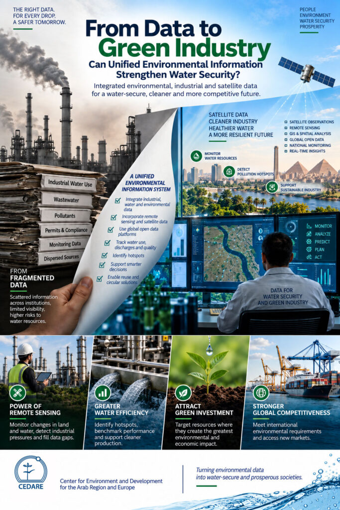
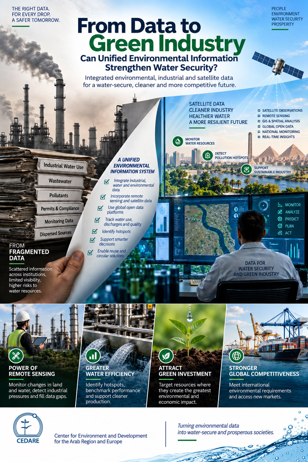
For water-scarce countries, the transition toward green industry is inseparable from water security. Industrial activities withdraw and consume water, generate wastewater, and can affect rivers, groundwater and surrounding ecosystems. Yet information on abstraction, consumption, wastewater discharge, pollution, treatment and reuse is often dispersed across institutions. This fragmentation makes it difficult to understand the complete industrial water cycle or identify where intervention is most urgently needed. UNEP stresses that consistent, quality-assured water data are fundamental to identifying pollution pressures, tracking change and supporting effective water-management decisions (UNEP, 2025).
A Unified Environmental Information System (UEIS) can bridge this gap by connecting environmental, industrial and water datasets. Instead of merely documenting compliance, an integrated system can help answer more strategic questions: Where is water being consumed? Which activities are placing pressure on water quality? Where are efficiency losses occurring? And where could treated wastewater become a resource rather than a waste stream?
The next generation of environmental information systems should not depend solely on data reported by individual facilities. Remote sensing, Earth observation, GIS and global open-data platforms can provide an additional layer of spatial and temporal intelligence. Satellite observations can help monitor changes in land and water conditions, detect environmental pressures over large areas and fill information gaps where conventional monitoring networks are limited.
FAO’s WaPOR platform demonstrates this potential. It provides open-access, remotely sensed information for monitoring water productivity across Africa and the Near East and supports analysis at global, national, basin and more detailed spatial scales. Its datasets include actual evapotranspiration, land cover, biomass and water-productivity variables, with some products available at resolutions down to 20 metres (FAO, 2026). Egypt is already included in WaPOR, with detailed coverage of Northern Egypt and the Nile Delta (FAO, 2026).
Integrating such global satellite-derived datasets with national monitoring and industrial information creates a more powerful model. Ground measurements can provide facility-level accuracy, while Earth observation adds geographic coverage, repeated observations and an independent perspective on changes occurring across watersheds and landscapes. FAO notes that near-real-time satellite information can support monitoring of actual water consumption and water productivity and improve water-management decisions (FAO, 2024).
For industry, this combination could help identify water-use and pollution hotspots, assess pressures around industrial zones, benchmark water efficiency, prioritise inspections and determine where cleaner production, wastewater treatment and reuse investments could produce the greatest environmental and economic returns.
Global Earth Observation + Remote Sensing + National Water Data + Industrial Data + Field Monitoring → Water Intelligence
CEDARE plays a valuable role at this intersection by linking national environmental information with remote sensing, GIS and international open-data platforms. This could include developing integrated indicators for water abstraction, consumption, water quality, wastewater treatment and reuse; establishing geospatial water and industrial dashboards; combining satellite observations with ground monitoring; and supporting institutional data harmonisation and capacity building.
More strategically, CEDARE could help develop a regional environmental and water intelligence framework for the Arab region, allowing countries to combine national information with globally available Earth-observation datasets. Comparable geospatial information could help reveal transboundary and regional patterns, identify areas of increasing water stress, support water accounting and evaluate opportunities for circular water management. FAO has already demonstrated that remotely sensed WaPOR data can support water accounting at basin, national and subnational scales, including applications covering Egypt and several Nile Basin countries (FAO, 2024).
The goal is no longer simply to know how much water industry uses. It is to build an intelligent picture from the facility to the satellite of where every drop comes from, where it goes, what happens to its quality, and where it can be saved, treated and used again.
References
FAO (2024) Irrigating from Space: How FAO-developed Remote Sensing Technology Can Make a Difference. Food and Agriculture Organization of the United Nations. FAO source
FAO (2024) WaPOR for Water Accounting. Food and Agriculture Organization of the United Nations. FAO Water Accounting case study
FAO (2026) WaPOR: Remote Sensing for Water Productivity – Data. Food and Agriculture Organization of the United Nations. FAO WaPOR data platform
FAO (2026) WaPOR Activities in Egypt. Food and Agriculture Organization of the United Nations. FAO WaPOR Egypt
UNEP (2025) Managing Water Data. United Nations Environment Programme, GEMS/Water.
UNIDO (2023) Eco-industrial Parks: Resource Efficiency and Industrial Symbiosis. United Nations Industrial Development Organization.
World Bank (2026) Digital Water. World Bank Group.